آموزش بررسی تکنیک های پیشرفته در SynthEyes
FXPHD - SYN301 - SynthEyes Advanced Survey Techniques

آموزش بررسی تکنیک های پیشرفته در SynthEyes
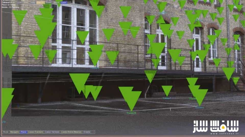
آموزش بررسی تکنیک های پیشرفته در SynthEyes : در این دوره شما قادر به فراگیری تکنیک های ثبت حرکت دوربین به وسیله نرم افزار SynthEyes هستید مدرس این دوره یعنی Victor Wolansky سعی در به کارگیری تکنیک هایی دارد که شما را با سایر هنرمدانی که در این عرصه مشغول فعالیت هستند متمایز کند. بعد از ترکینگ شات های مذکور مدرس اقدام به ایمپورت اطلاعات و مختصات نقاط در نرم افزار تری دی مکس میکند. این دوره آموزشی توسط تیم ســافــت ســاز برای شما عزیزان تهیه شده است.
عناوین اصلی دوره آموزشی :
- ترکینگ و ردیابی حرکت دوربین
- ترکینگ حرکت دو دوربین به صورت همزمان
- افزودن دیستورشن برای طبیعی جلوه دادن کار
- برطرف کردن مشکلات احتمالی در حین کار
عنوان دوره : FXPHD – SYN301 – SynthEyes Advanced Survey Techniques
سطح : پیشرفته
زمان کل دوره : 7.20 ساعت
تعداد فایل های تصویری : 10
سال آموزش : 2013
فایل تمرینی : –
مربی دوره : VICTOR WOLANSKY
نرم افزار : SynthEyes
زیرنویس انگلیسی : ندارد
FXPHD – SYN301 – SynthEyes Advanced Survey Techniques
In this advanced course, Victor Wolansky will share advanced techniques on how to use survey information for a variety of purposes. This includes how to match cameras to real world coordinates, cross link tracking points from multiple cameras for better precision, and using survey data from Survey Stations. This is information which is very precise, so much so that you can force SynthEyes to constrain to those points to even solve shots without any motion.
Later we will export these shots with multiple cameras to 3DS MAX and keep it all in real world units to match purchased or modeled to real sizes. We will also take a look the new distortion / undistortion workflow in the app as well as examine how to use LIDAR scans in SynthEyes and constrain tracking points to the point could.
Quite a few new very useful features where included in SynthEyes in the last versions, and the “Phases” is anptjer invaluable tool we are going to be using along the course.
CLASS 1
Tracking of camera along a road with surveyed information, alignment and scaling to real world coordinates.
CLASS 2
Tracking of two moving cameras Part 1. With survey information and 2 static cameras, different resolutions and different aspect ratios, one is a panorama. Crosslink of all the cameras.
CLASS 3
Tracking of two moving cameras Part 2.
CLASS 4
New undistortion / distortion with After Effects.
CLASS 5
Importing of all these cameras, maintaining real size measurements, aligning with a road built based on the survey data. Some techniques in MAX / Final render to match lighting, catch shadows, reflections, etc.
CLASS 6
Using 3D objects to assist tracking, having geometries to constraint the trackers makes things easier.
CLASS 7
LIDAR recommendations and learning new ways to navigate the software, getting comfortable with perspective navigation is a must to deal with huge sets.
CLASS 8
LIDAR Tracking two shots, a simple one and one that is pretty complicated.
CLASS 9
LIDAR finishing shots, using shadow catchers with test objects given our ground is lower than zero.
CLASS 10
Completing the difficult track from the previous lesson.
حجم کل : 10 گیگابایت

برای دسترسی به کل محتویات سایت عضو ویژه سایت شوید
برای نمایش این مطلب و دسترسی به هزاران مطالب آموزشی نسبت به تهیه اکانت ویژه از لینک زیر اقدام کنید .
دریافت اشتراک ویژه
مزیت های عضویت ویژه :
- دسترسی به همه مطالب سافت ساز
- آپدیت روزانه مطالب سایت از بهترین سایت های سی جی
- ورود نامحدود کاربران از هر دیوایسی
- دسترسی به آموزش نصب کامل پلاگین ها و نرم افزار ها
اگر در تهیه اشتراک ویژه مشکل دارید میتونید از این لینک راهنمایی تهیه اشتراک ویژه رو مطالعه کنید . لینک راهنما
For International user, You can also stay connected with online support. email : info@softsaaz.ir telegram : @SoftSaaz
امتیاز به این مطلب :
امتیاز سافت ساز
لطفا به این مطلب امتیاز دهید :)


