آموزش طراحی جاده با AutoCAD Civil 3D
Udemy - Road Design with AutoCAD Civil 3D (+BONUS Corridor Content)

آموزش طراحی جاده با AutoCAD Civil 3D
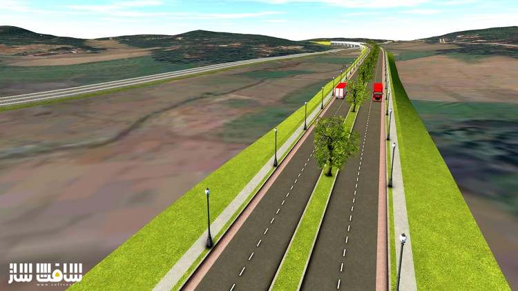
در این آموزش طراحی جاده با AutoCAD Civil 3D از هنرمند Jeew -M، با صفر تا صد ساخت یک جاده با نرم افزار AutoCAD Civil 3D آشنا خواهید شد. این دوره یک پروژه را از صفر تا صد انجام خواهد داد. هدف از این دوره اتصال یک شهر به یک منطقه صنعتی با جاده دو طرفه دو بانده با سرعت 50 کیلومتر در ساعت است. این دوره آموزشی توسط تیم ســافــت ســاز برای شما عزیزان تهیه شده است.
عناوین اصلی دوره آموزشی :
- شناخت اینترفیس AutoCAD Civil 3D
- شناخت سبک های آبجکت Civil 3D
- باز کردن ترسیم جدید با Civil 3D
- ایمپورت نقاط به Civil 3D
- مجموعه رفرنس خارجی برای نقشه های AutoCAD
- ایجاد سطوح از نقاط
- افزودن Surface Boundary به سطوح Civil 3D
- اکسپورت سطوح Civil 3D به LandXML
- ایجاد Alignment در Civil 3D
- ایجاد لایوت جاده در ترسیم
- ایجاد Surface Profile و Profile View
- ایجاد اسمبلی ،ایجاد راهرو
- و …
عنوان دوره : Udemy – Road Design with AutoCAD Civil 3D (+BONUS Corridor Content)
سطح : متوسط
زمان کل دوره : 4.39 ساعت
تعداد فایل های تصویری : 40
سال آموزش : 2021
فایل تمرینی : دارد
مربی دوره : Jeew -M
نرم افزار : AutoCAD Civil 3D
زیرنویس انگلیسی : دارد
Udemy – Road Design with AutoCAD Civil 3D (+BONUS Corridor Content)
In this course, you will learn how to design a road with AutoCAD Civil 3D software from the basics. We will be doing this as a project from start to end. The software version we use is Autodesk Civil 3D 2020. Any Civil 3D version newer than Civil 3D 2018 can be used to follow this course.
Before doing this course it would be an advantage if you have some insight into AutoCAD basics. This course is created more related to a Highway Engineering background. So the Engineers or Engineering students would find this very useful to start their carrier as a Highway Design Engineer.
The project objective is to connect a City to an Industrial zone with a two-lane two-way road with a design speed of 50km/h.
We will be using AASHTO 2011 design guidelines as the design reference when doing the designs.
The following list shows the aspects we are covering throughout this course.
1. Introduction – Road Design With AutoCAD Civil 3D
2. Understanding AutoCAD Civil 3D Interface
3. Understand Civil 3D Object Styles, Label styles, and Label Sets
4. Open New Drawing with Civil 3D
5. Import Points into Civil 3D
6. Set External Reference for AutoCAD drawings
7. Create Surface from Points
8. Add Surface Boundary to Civil 3D Surface
9. Add Breaklines to Surface to Civil 3D Surface
10. Export Civil 3D Surface to LandXML
11. Open New Civil 3D Template drawing and Import LandXML Surface into Civil 3D
12. Create Alignment in Civil 3D
13. Create Road Layout in drawing
14. Create Surface Profile and Profile View
15. Add Superelevation to Alignment
16. Create Final Road Profile
17. Set the data bands for Profile View
18. Create Assemblies
19. Create Corridor
20. Target Mapping
21. Split Corridor
22. Create Corridor Surfaces
23. Create Sample Lines and Section Views
24. Calculate Material Quantities
حجم کل : 2.6 گیگابایت

برای دسترسی به کل محتویات سایت عضو ویژه سایت شوید
برای نمایش این مطلب و دسترسی به هزاران مطالب آموزشی نسبت به تهیه اکانت ویژه از لینک زیر اقدام کنید .
دریافت اشتراک ویژه
مزیت های عضویت ویژه :
- دسترسی به همه مطالب سافت ساز
- آپدیت روزانه مطالب سایت از بهترین سایت های سی جی
- ورود نامحدود کاربران از هر دیوایسی
- دسترسی به آموزش نصب کامل پلاگین ها و نرم افزار ها
اگر در تهیه اشتراک ویژه مشکل دارید میتونید از این لینک راهنمایی تهیه اشتراک ویژه رو مطالعه کنید . لینک راهنما
For International user, You can also stay connected with online support. email : info@softsaaz.ir telegram : @SoftSaaz
امتیاز به این مطلب :
امتیاز سافت ساز
لطفا به این مطلب امتیاز بدید 🦋


